 |
 |
 |
 |
 |
      |

Guidebooks
|
|
Thanks to the Argonauta’s
extensive library, you can continue to
explore places previously unknown to
you, and to fully discover the history
of this isolated outpost in the middle
of the Atlantic, there is one person who
has written numerous books: the founder
of the Argonauta (1991), Pierluigi
Bragaglia, who for over 26 years has
been one of the few Italians to have
published historical books in Portuguese
and English: *Flores, Azores - Walking
through History - A Guide to the
Island’s Paths and Past* (2009),
which is his latest work. He is the best
person to guide you through the trails
and sites of Flores.
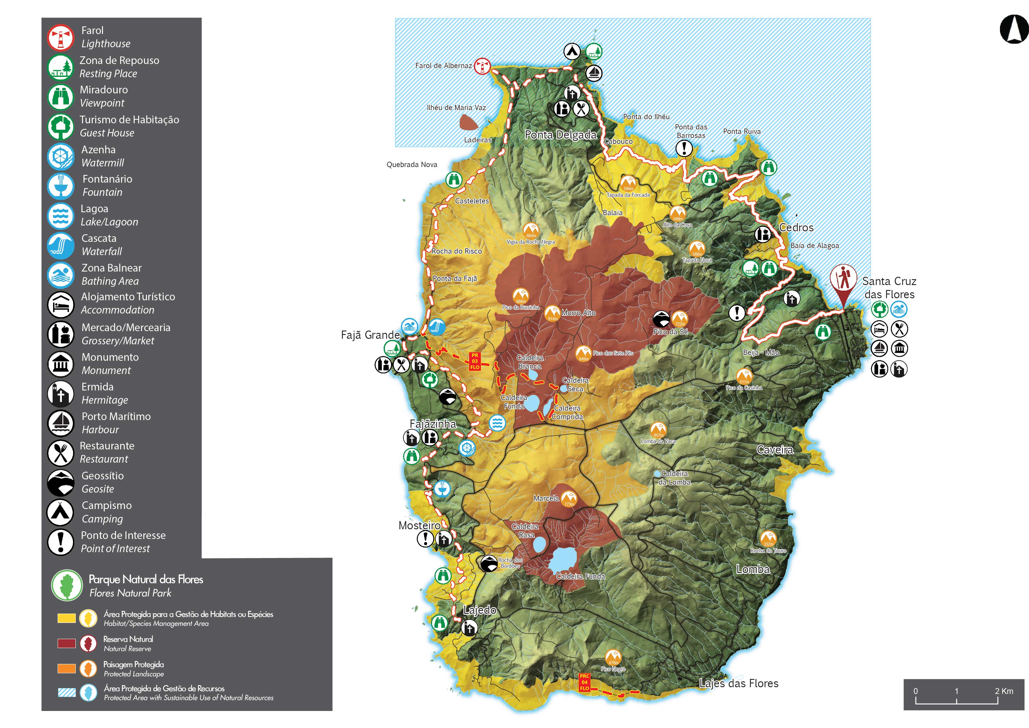
On August 18, 2016, the Grande
Rota das Flores was inaugurated;
with the opening of the eastern routes,
it now connects to the existing trails
along the west coast. It begins in Santa
Cruz das Flores (eastern region),
heading north/northwest to Ponta Delgada
(Stage 1 – 21 km route), a new trail
waiting to be discovered. It then
continues south (Stage 2 – 26 km route)
through Fajã Grande, and ends in Lajedo
(southwest), for a total length of 47
km. There are sections where the rocky
ground can be slippery, so it is
advisable to exercise caution and wear
appropriate footwear. Falling rocks and
boulders on some trails are not entirely
uncommon, which is why we advise against
listening to music while hiking. This
route can be divided into two stages:
the first, about 21 km long, is highly
challenging, mainly due to the terrain’s
topography, which constantly takes you
through mountains, deep valleys, and
high cliffs; the second, about 25 km
long, is also highly challenging,
initially taking you through areas at an
altitude of 400 m, but without the steep
ascents and descents of the first stage;
however, it does feature some trails
that may cause dizziness.
Italians to have published books in
English and Portuguese: Flores, Azores -
Walking through
History - A guide to the island's
paths and past (2009), is his last
opera and at the same time is a good
guide to the paths and not of Flores.
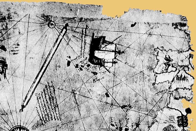
Piri Reis Map dated 1513 -
Particular of the Azores
STAGE 1 —
This stage begins at the northern end of
the airport runway. With Corvo on the
horizon, turn left and follow the road
to the elevated area of Beija Mão (above
300 m), where you can enjoy a view of
the villages below. From here, the trail
descends, passing through the Luís Paulo
Camacho Recreational Forest Reserve and,
further ahead, the hydroelectric power
plant. Cross the dam and continue along
a dirt path parallel to a levada
(irrigation canal), heading toward the
sea. When you reach the regional road,
follow the trail markers—with the
village of Fazenda on your right—toward
Alagoa Bay. At this point, you are
already at sea level, deep within a
valley; continue along a rural road to
your right, passing through a picnic
area with views of the islets, and
follow the coastline toward Cedros. Now,
continue climbing the steep cliff to an
altitude of over 300 m, cross this small
parish, and descend slightly toward
Ponta Ruiva, in the northeast of the
island.
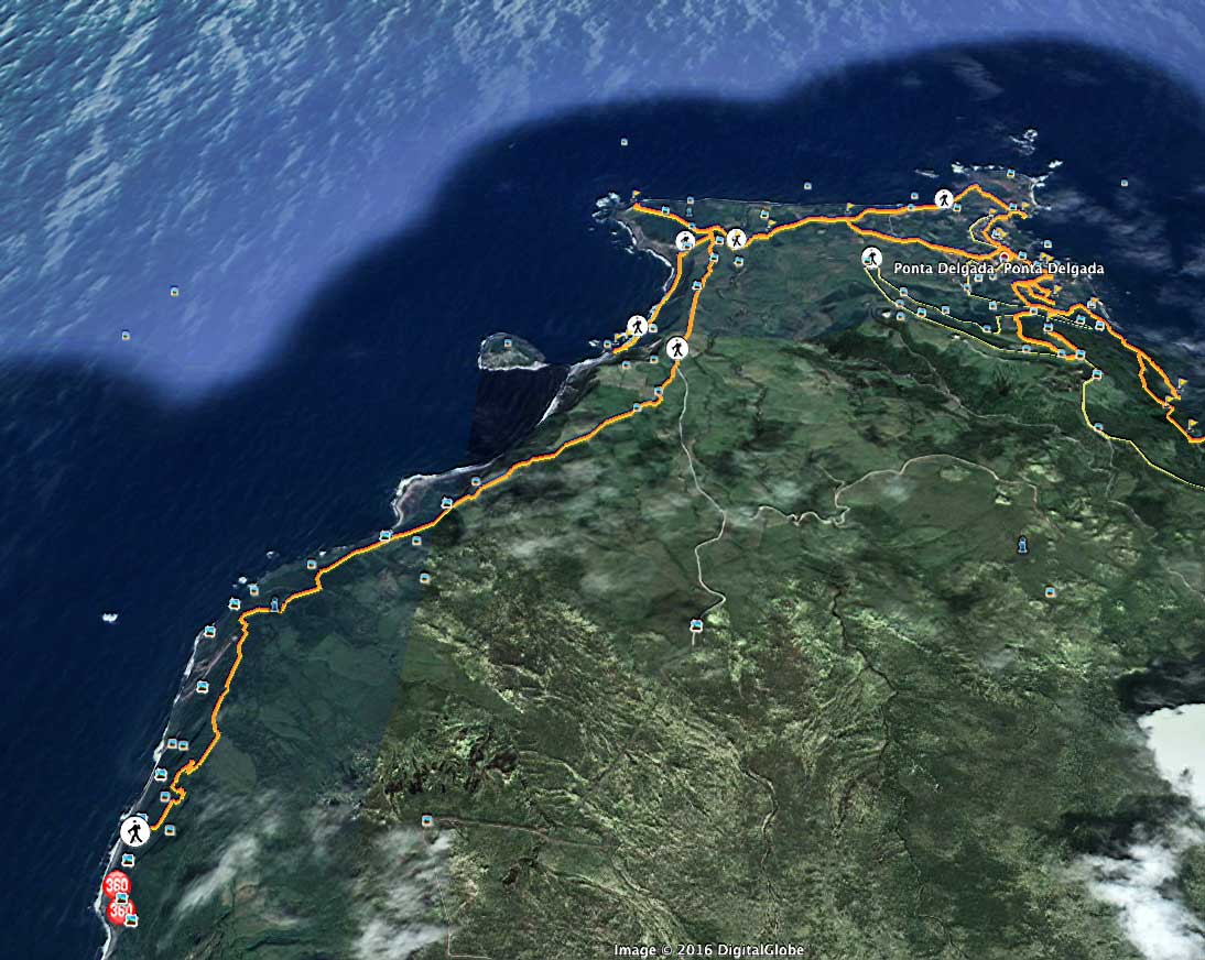
From here, the trail continues to Ponta
Delgada along the coast, winding up and
down through several sites of great
natural beauty, such as Ponta das
Barrosas—where the remains of an ancient
settlement can be found—Cabouco, and
Pico do Meio Dia. Along this route, you
can admire various examples of endemic
flora, such as Azores heather (Erica
azorica), Azores picconia (Picconia
azorica), and Azores holly (Ilex
azorica). Now head down to the
small coastal town of Ponta Delgada,
pass by the Chapel of Nossa Senhora da
Guia, and finish this section in the
town center, next to the Casa do Povo.
STAGE 2 - Begin
this stage at Casa do Povo, with Corvo
Island on the horizon. Along the trail,
whenever you need to go through a gate,
be sure to close it behind you. There
are some sections where the rocky ground
can be slippery, and after days of heavy
rain, the water levels along the
riverbanks rise; it is advisable to
exercise caution and wear appropriate
footwear. Follow the road through
pastures and farmland until it turns
south. At this point, there is a turnoff
to the right leading to the Ponta de
Albernaz lighthouse. After visiting the
lighthouse, continue south. With the
islet of Maria da Vaz roughly on your
right, leave the paved road and take the
dirt/concrete road ahead of you,
following the PR
01 FLO trail. Descend
Rocha do Risco—be aware of the
risk of vertigo—through a forested
area with large Azores junipers (Juniperus
brevifolia) until you reach
Ponta da Fajã. Follow the trail
markers, passing the turnoff to
Poço do Bacalhau—a spot connected
to other parts of the island via
the PR
03 FLO trail (Miradouro das
Lagoas/Poço do Bacalhau)—and
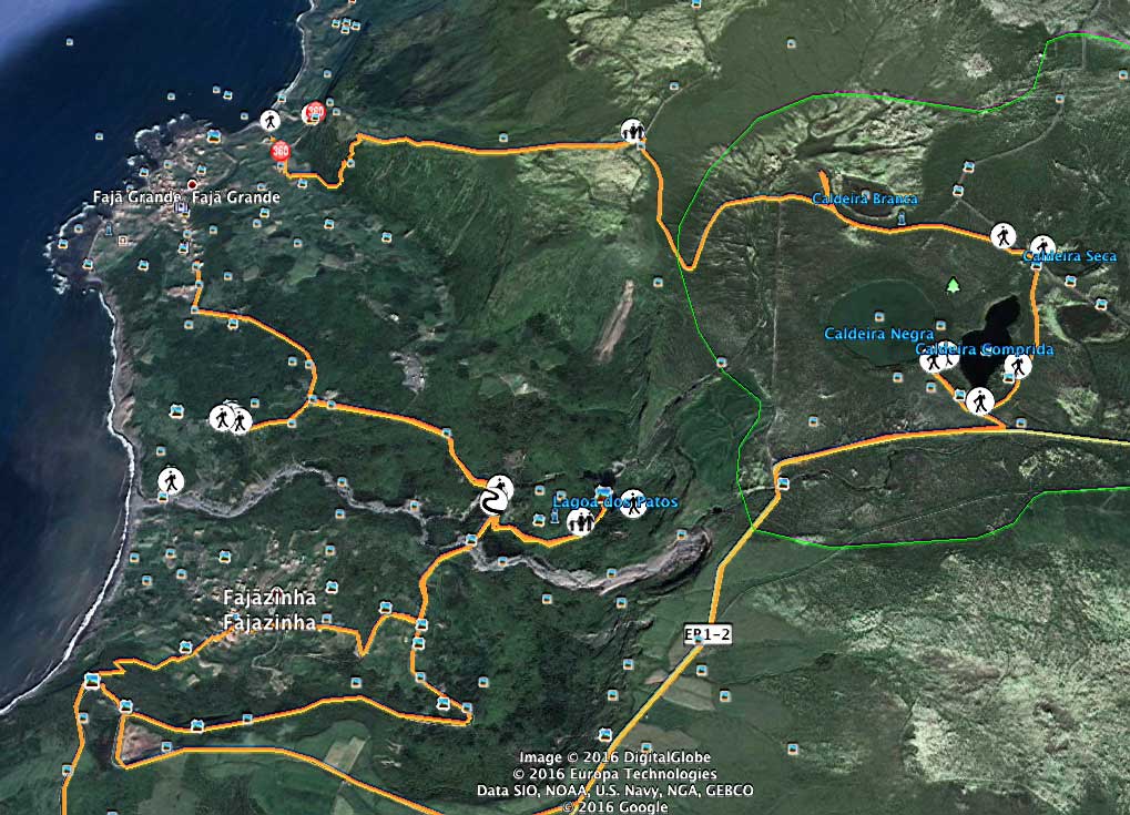
continue to the center of Fajã
Grande, where you can stop for a
swim. Follow the trail markers
along the base of the cliff on a
rural path, and when you reach the
main road, you’ll find a turnoff
to your left leading to Lagoa dos
Patos, a tourist attraction on the
island. After taking the detour
along the PR
02 FLO trail, return by the
same path, pass a watermill, and
continue to the right along a
rural road parallel to the stream
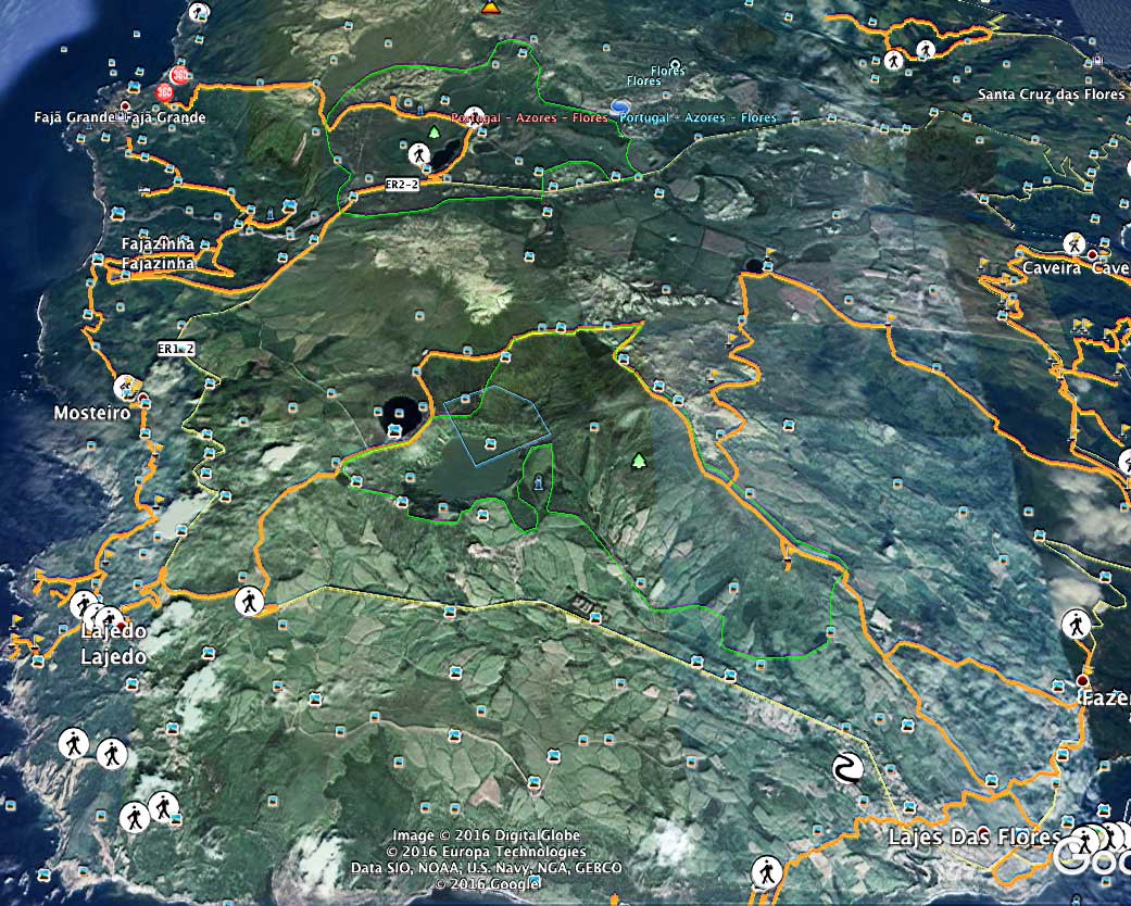
until you reach Fajãzinha. Cross
the village, climb the hillside,
and continue along the road,
passing through once-inhabited
sites such as Caldeira, until you
reach the village of Mosteiro.
Heading south, you’ll find, on
your right, a lookout point
offering views of the coast and
Rocha dos Bordões, a geological
formation known for its enormous
vertical basalt columns. From
here, the route continues south to
Lajedo, passes by the lookout
point, and continues to the center
of the village, where it ends.
Residents of Fajã Grande can also
easily take a ride to the PR
01 FLO, the PR
02 FLO, or the Grande
Rota, ending their walk back
home in Fajã Grande.
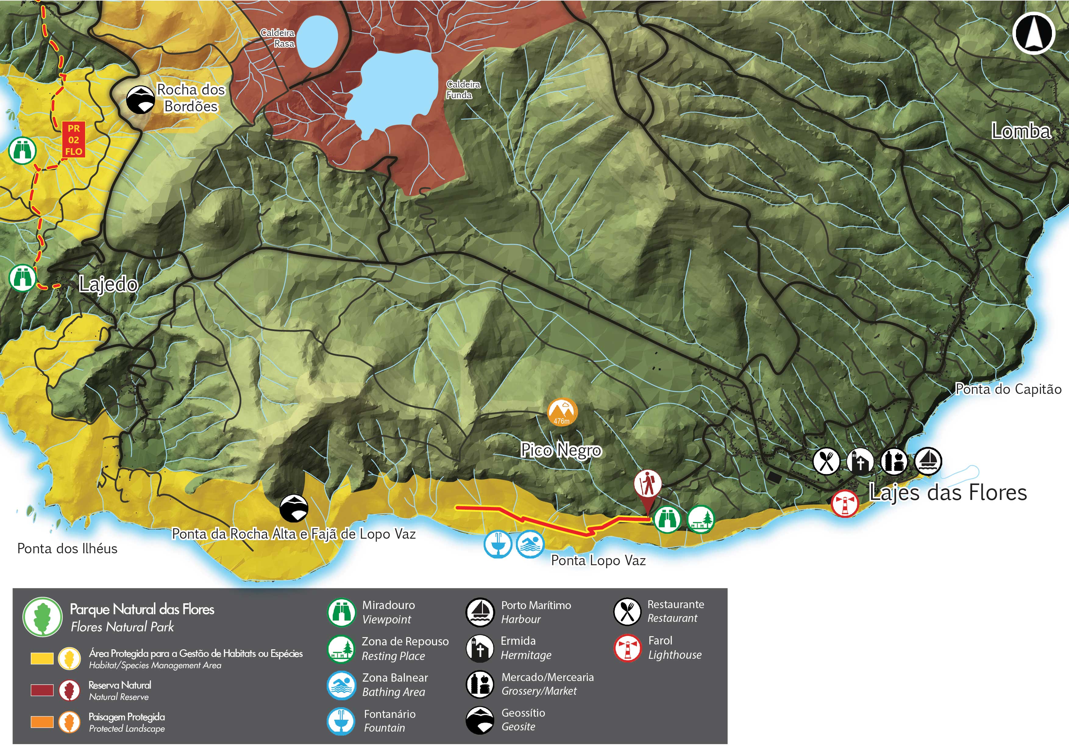
To the south, near Lajes, the PR
04 FLO trail begins at the Punta
de Lopo Vaz Lookout and continues along
a single path to Fajã de Lopo Vaz. Start
by descending a stone staircase flanked
by endemic vegetation, such as Azores
heather (Erica
azorica), the fire tree (Morella
faya), and the whitewood (Picconia
azorica). After 1.25 km, near the
first house, you’ll see a black-sand
beach on your left. Follow the path to
the right and pass by the remaining
houses in the fajã (strip of land along
the sea) until you reach a private
property overlooking Ponta da Rocha
Alta. At this point, return along the
same path to the Fajã Viewpoint.
• Updated
by Nadia Ferreira and Stéfano Folgaría
on September 23, 2016, based on a single
source: Azores
Regional Tourism Directorate •
| Home | Location | Facilities |
Services |
Prices | Guidebooks
| E-mail
 | |
|
| |
|
|